ArcGrid
Note
GeoServer does not come built-in with support for ArcGrid; it must be installed through an extension. Proceed to Installing the ArcGrid extension for installation details.
ArcGrid is a coverage file format created by ESRI.
Installing the ArcGrid extension
-
Visit the website download page, locate your release, and download:
- 3.1.0 geoserver-3.1.0-arcgrid-plugin.zip
- 3.1.0-SNAPSHOT geoserver-3.1.0-SNAPSHOT-arcgrid-plugin.zip
Warning
Ensure to match plugin (example 3.1.0 above) version to the version of the GeoServer instance.
-
Extract the contents of the archive into the
WEB-INF/libdirectory of the GeoServer installation.
Adding an ArcGrid data store
Once the extension is properly installed ArcGrid will be an option in the Raster Data Sources list when creating a new data store.
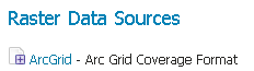
ArcGrid in the list of raster data stores
Configuring a ArcGrid data store
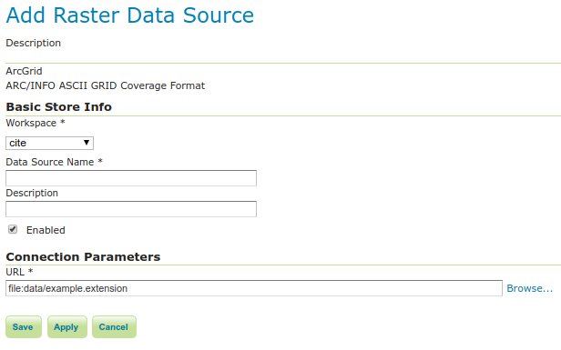
Configuring an ArcGrid data store
| Option | Description |
|---|---|
Workspace |
Name of the workspace to contain the ArcGrid coverage store. This will also be the prefix of the raster layers created from the store. |
Data Source Name |
Name of the ArcGrid coverage store as it will be known to GeoServer. (This can be different from the filename. ) |
Description |
A full free-form description of the ArcGrid coverage store. |
Enabled |
If checked, it enables the store. If unchecked (disabled), no data in the ArcGrid coverage store will be served from GeoServer. |
URL |
Location of the ArcGrid file. This can be an absolute path (such as file:C:\Data\raster.asc) or a path relative to GeoServer's data directory (such as file:data/raster.asc). |