OGC API Service Configuration
The OGC API services provide additional services alongside the existing Open Web Services (OWS).
Service
The OGC API services primarily share the same configurations with their equivalent OWS services. For example, setting the limited SRS list on the Services > Vectors page also limits the SRS list for OGC API - Features.
In addition, the OGC API services will have some unique configuration options.
Security
-
Data security: Data security is managed independently of web service. The same data security restrictions placed on a workspace or layer content are enforced for both OWS services and OGC API web services
-
Service security: OGC API web services are managed directly in Security > Services page. New access rules can be defined for OGC API services.
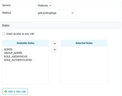
Service rule for OGC API Features getLandingPage
Conformance
Each OGC API web service is modular, with supported functionality listed in a conformance document.
-
OpenAPI service description is mandatory and may not be disabled.
-
Built-in output formats (such as HTML and JSON) may not be disabled.
The Conformance Table is used to manage each group of standards:
-
You may enable/disable the functionality included using checkboxes provided.
The checkboxes cycle through Enabled to include a conformance, Disabled to exclude, and Unset (shown as a
-line). -
The appearance of each conformance Identifier is normal when included in the
conformancedocument, and light gray when not included.The table reflects interaction between conformance settings. For example Filtering requires at least one filter language (CQL2 or ECQL) to be enabled in order to specify a filter parameter.
-
When a checkbox is Unset the conformance is included depending on how stable a Standard is (Draft standards are still subject to change), the GeoServer implementation (Implementing indicates functionality that is under development), and the Strict CITE compliance setting used to limit functionality to endorsed OGC standards.
Standard Endorsed Stable Default Strict Description Standard OGC Stable Enabled Enabled Finalized standard Implementing OGC Finalized standard, implementation under development. Draft OGC Draft standard, subject to change. Retired Stable Enabled Retired standard, implementation available for backwards compatibility. Community Standard Stable Enabled Non-OGC Standard Community Draft Non-OGC Standard, subject to change. 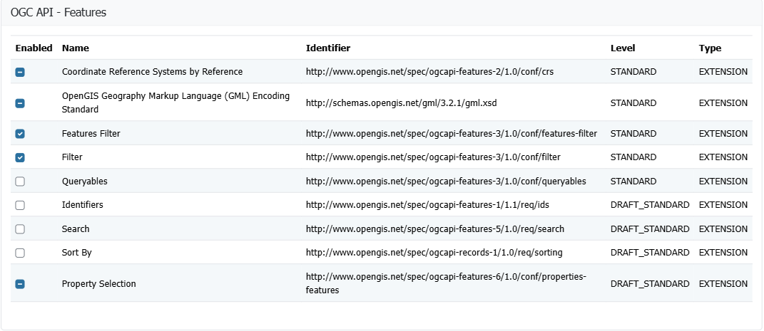
OGC API - Features conformance table
As an example the GeoServer project lists our own ECQL query language alongside the official CQL2 query language. When using strict only the CQL2 query language would be available by default.

ECQL conformance table
Note
This approach allows GeoServer to share work-in-progress (both draft standards and implementations being worked on). Use the checkboxes to Enable such functionality for feedback and review, or leave Unset and it will only be included when ready.
Collections
OGCAPI web services provides a collections resource describing the published content.
As an example OGC API - Features collections lists:
- links: Links and metadata
- collections: List of individual collections available
- crs: List of coordinate reference systems defined by WFS settings
Custom links for the "collections" resource
The collections resource can have a number of additional links, beyond the basic ones that the service code already includes.
Navigate to Server > Global Settings.
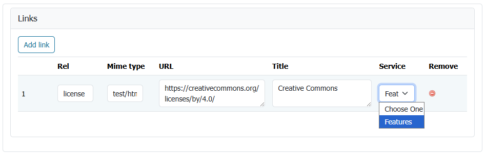
Links used to indicate global Creative Commons license
Link editor column description:
- rel: the link relation type, as per the OGC API - Features specification
- Mime type: the mime type for the resource found following the link
- URL: the link URL
- Title: the link title (optional)
- Service: the service for which the link is valid (optional, defaults to all)
Common links relationships that could be added for the collections resource are:
enclosure, in case there is a package delivering all the collections (e.g. a GeoPackage, a ZIP full of shapefiles).describedBy, in case there is a document describing all the collections (e.g. a JSON or XML schema).license, if all collection data is under the same license.
Example from OGC API - Features service (<http://localhost:8080/geoserver/ogc/features/v1/collections/?f=application%2Fjson>):
{
  "href": "https://creativecommons.org/licenses/by/3.0/",
  "rel": "license",
  "type": "text/html",
  "title": "Creative Commons - Attribution"
}
Custom links for workspace collections
Additional custom collections links can also be defined for an individual workspace. Navigate to Workspaces > Edit Workspace. Links are configured on the Basic Info tab.
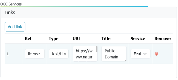
Links used to indicate public domain license for ne workspace
In this example the license is changed to reflect the natural earth terms of use (overriding the license defined in global settings).
Example from workspace OGC API - Features service ( http://localhost:8080/geoserver/ne/ogc/features/v1/collections/?f=application%2Fjson):
{
  "href": "https://www.naturalearthdata.com/about/terms-of-use/",
  "rel": "license",
  "type": "text/html",
  "title": "Public Domain"
}
Single collection
Each GeoServer layer is published is represented in OGC API as a single collection.
As an example OGC API - Features collections lists:
- id: Layer name
- title: Layer title
- description: Layer abstract
- extent: Layer bounds
- links: Links to access content and metadata
- crs
- storageCrs
Custom links for single collection
Additional custom links can be provided for an individual layer. Use the Layer Editor Publishing tab, and locate the heading for OGC API.
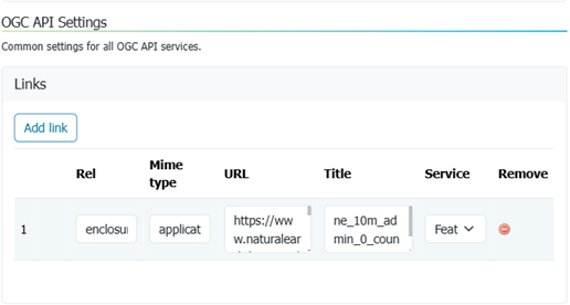
Links used to define enclosure download for ne:countries layer
The relationships are the same as for the collections resource, but used in case there is anything that is specific to the collection (e.g., the schema for the single collection).
In addition, other relations can be specified, like the tag relation, to link to the eventual INSPIRE feature concept dictionary entry.
Example from workspace ne:countries collection providing enclosure for download: