Using the RAT Module
The RAT modules adds facilities to explore a Raster Attribute Table, and generate styles based on a classification column of choice.
If the source raster contains a RAT, a new panel will appear in the Publishing tab of the layer.
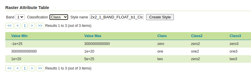
The table allows for exploration of the attribute table, while the toolbar at the top allows to generate styles based on the table contents:
- The Band dropdown allows to select a raster band.
- The Classification dropdown allows to select a column to use for classification. Geometry columns are not listed, as each row holds a different geometry, so it groups nothing.
- The Style name controls the name of the style to be generated. It's automatically filled with a naming convention of
<layer>_b<band>_<classification>, but can be customized. - The Create style button generates the style based on the chosen classification, eventually using colors if available in the table, otherwise generating random colors. The generated style will also be included among the "alternate styles" of the layer.
The generated style will match all the values in the raster attribute table, and ensure the chosen classification column is used for both styling, legend generation, and GetFeatureInfo output.
In the GetFeatureInfo output the table columns keep their type: a number stays a number, a boolean stays a boolean, and a date and time column is reported as a date, converted to UTC. An empty cell is reported as no value at all, unless the column holds text, where it stays an empty text. Geometry columns are reported as text, in the well known text form.
Here is an example style:
<?xml version="1.0" encoding="UTF-8"?><sld:StyledLayerDescriptor xmlns:sld="http://www.opengis.net/sld" xmlns:gml="http://www.opengis.net/gml" xmlns:ogc="http://www.opengis.net/ogc" xmlns="http://www.opengis.net/sld" version="1.0.0">
  <sld:NamedLayer>
    <sld:Name>Class</sld:Name>
    <sld:UserStyle>
      <sld:Name>Class</sld:Name>
      <sld:FeatureTypeStyle>
        <sld:Rule>
          <sld:Name>Class</sld:Name>
          <sld:RasterSymbolizer>
            <sld:ColorMap type="intervals">
              <sld:ColorMapEntry color="#000A64" opacity="1.0" quantity="-1.0E25" label="zero"/>
              <sld:ColorMapEntry color="#641400" opacity="1.0" quantity="3.0E12" label="one"/>
              <sld:ColorMapEntry color="#C81E32" opacity="1.0" quantity="1.0E20" label="two"/>
              <sld:ColorMapEntry color="#FFFFFF" opacity="0.0" quantity="5.0E25"/>
            </sld:ColorMap>
            <sld:VendorOption name="addAttributeTable">true</sld:VendorOption>
          </sld:RasterSymbolizer>
        </sld:Rule>
      </sld:FeatureTypeStyle>
    </sld:UserStyle>
  </sld:NamedLayer>
</sld:StyledLayerDescriptor>
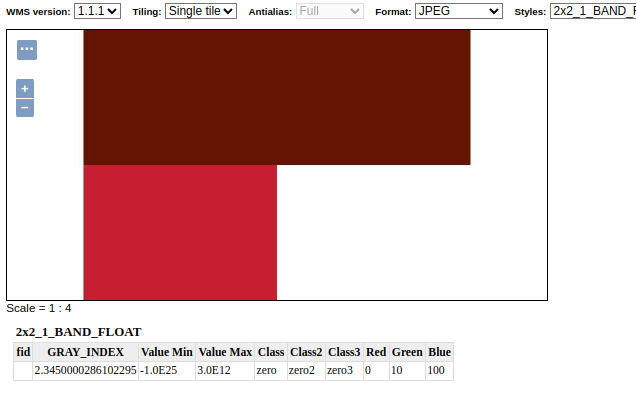
This is a map generated using the style, with the GetFeatureInfo containing the classification as an extra attribute:
Mosaics
An ImageMosaic can build one attribute table out of the tables of its granules. It is off by default, enabled with the CollectAttributeTables indexer property, while AttributeTableGeometries controls what happens to a geometry column the granules disagree on. See ImageMosaic configuration.
REST API
A REST API is available, to fetch the full PAM dataset attached to a raster, and to create styles out of RAT classification fields: