Configure the Microsoft Azure authentication provider
We will use Microsoft Entra (Microsoft Azure) for login and either the Azure/Entra ID Token or Microsoft Graph to provide roles.
Configure Microsoft Entra
Go to Microsoft Entra and login
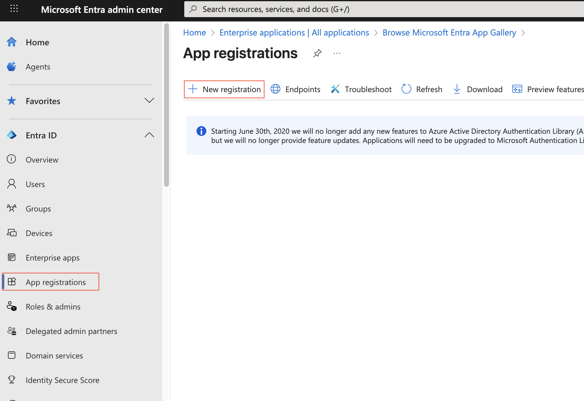
Click on “App Registration” (left column), then “+ New Registration” (top bar)
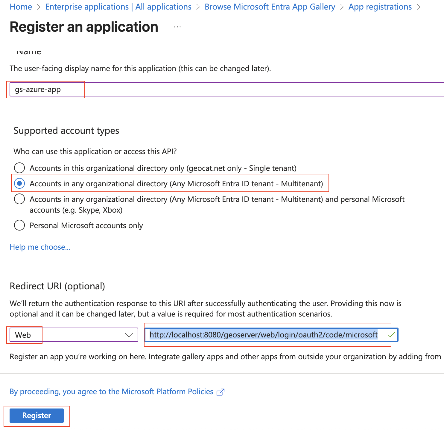
Give the application a name (“gs-azure-app”), set it to the MultiTenant. Use “http://localhost:8080/geoserver/web/login/oauth2/code/microsoft” as the “Web” Redirect URI. Press “Register”.
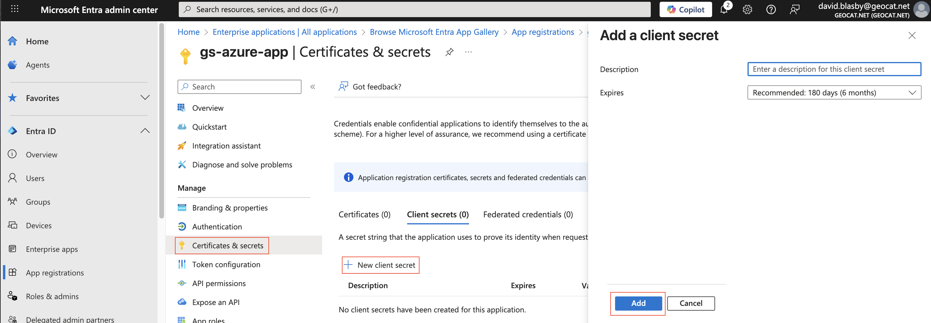
On the app summary screen, press “Certificates & Secrets”, “+ New client secret”, then press “Add”.
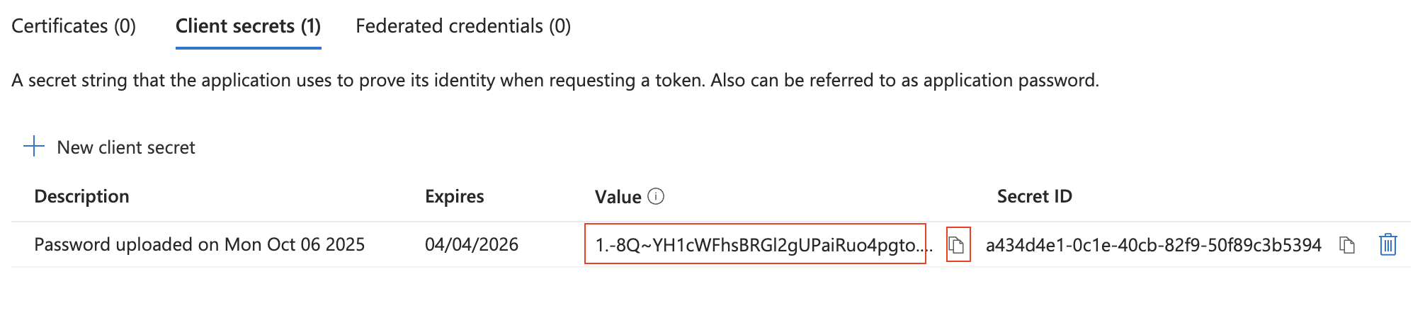
Make sure you copy-and-paste the created Client Secret - you will need this later and you can only access now. Ensure you got the “Value” (not the ID).
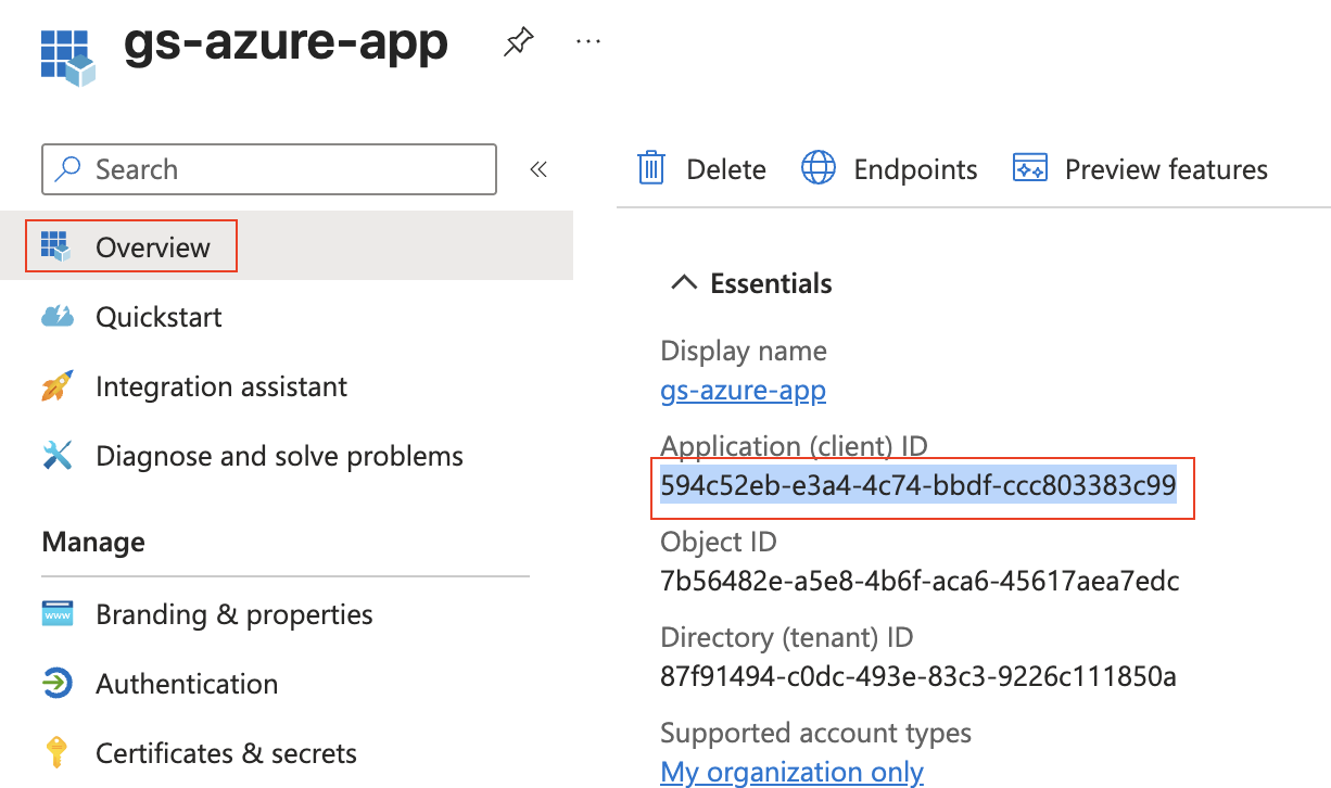
Press “Overview” (left column) and record the “Application (client) ID” - you will need this later.
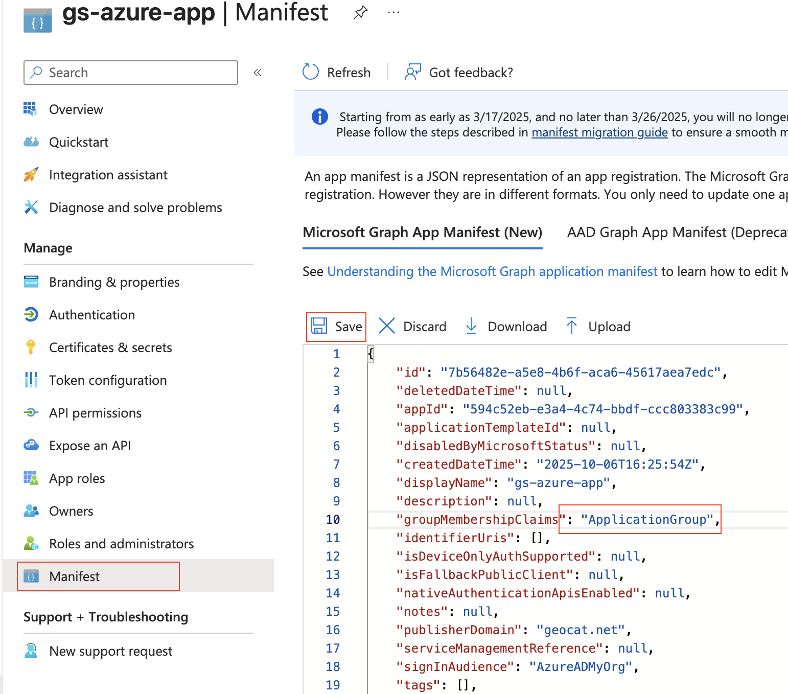
Press “Manifest” (left column), and change “groupMembershipClaims”:null, to “groupMembershipClaims”: “ApplicationGroup”, and press “Save”. This puts the roles in the ID Token.
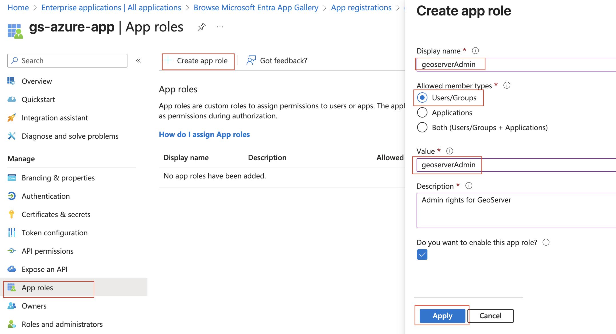
Press “Add roles” (left column), then “+ Create App role”, set the “Display name” and “Value” to “geoserverAdmin” and press “Apply”.
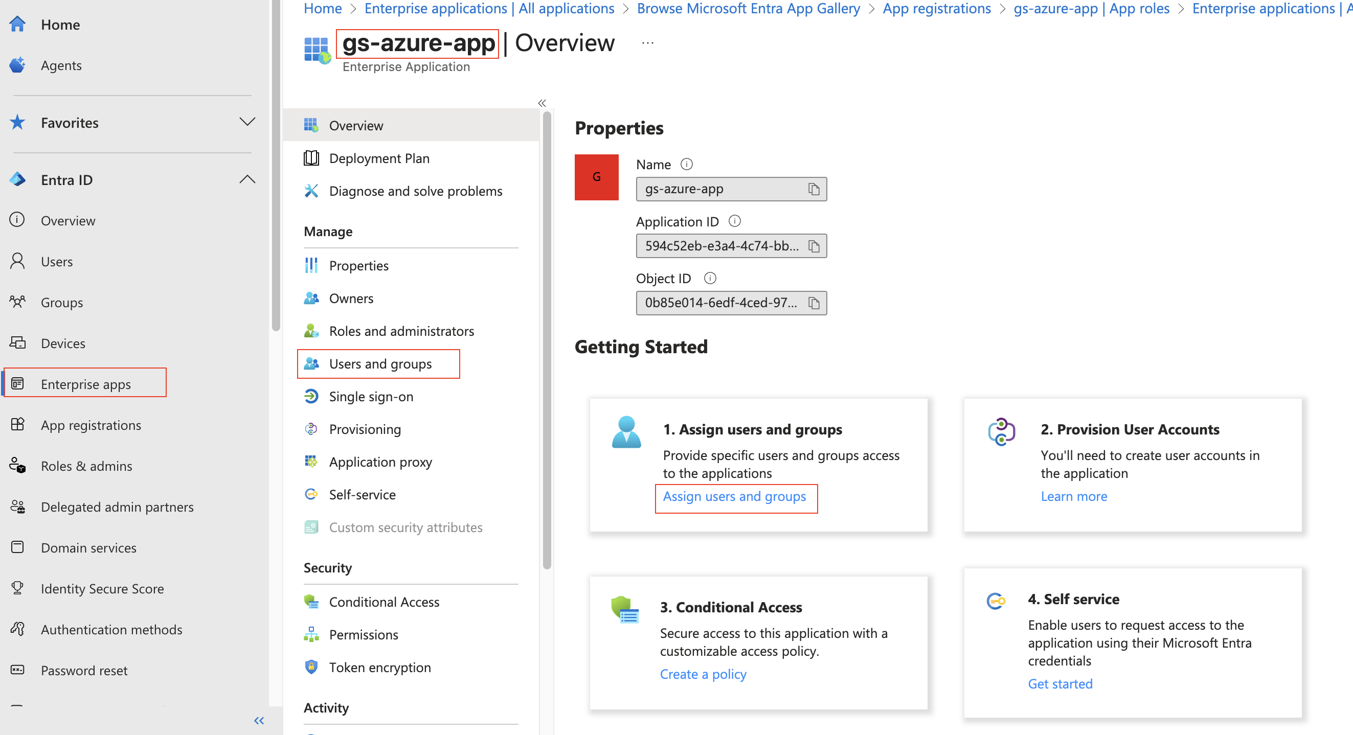
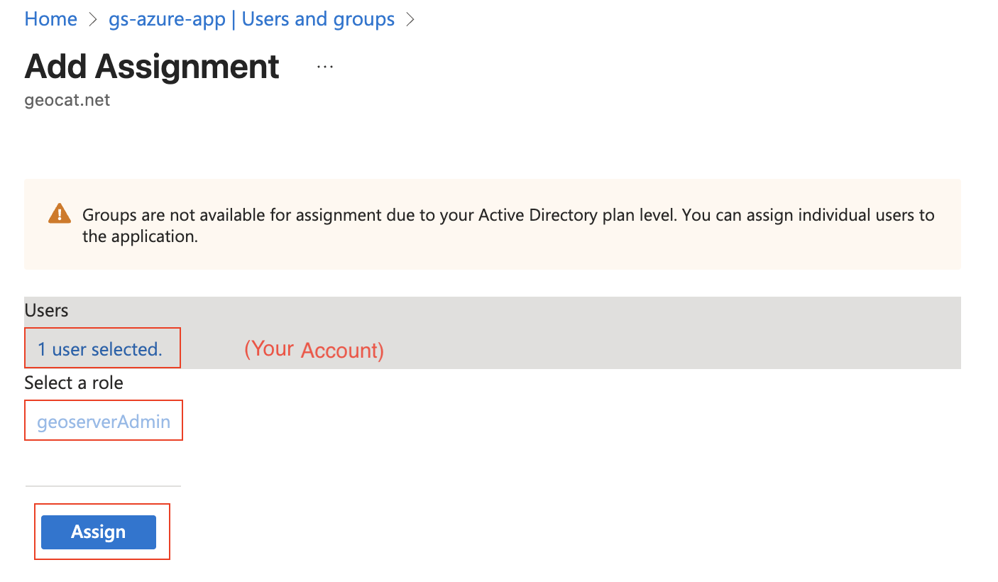
Press “Enterprise Apps” (far left column), choose your application (“gs-azure-app”), and press “Assign users and groups”.
At the top press “+ Add user/group”. Under “Users”, press “None Selected” and then choose your account. Under “Select a role”, keep the selection as “geoserverAdmin”. Press “Assign”.
Configure GeoServer
The next step is to configure your Azure Application as the OIDC IDP for GeoServer.
Ensure you have the following:
Your Client ID (“Application (client) ID”). This is a guid.
Your Client Secret. This is a guid.
Name of the geoserver admin Role (“geoserverAdmin”)
Create the OIDC Filter
Login to GeoServer as an Admin
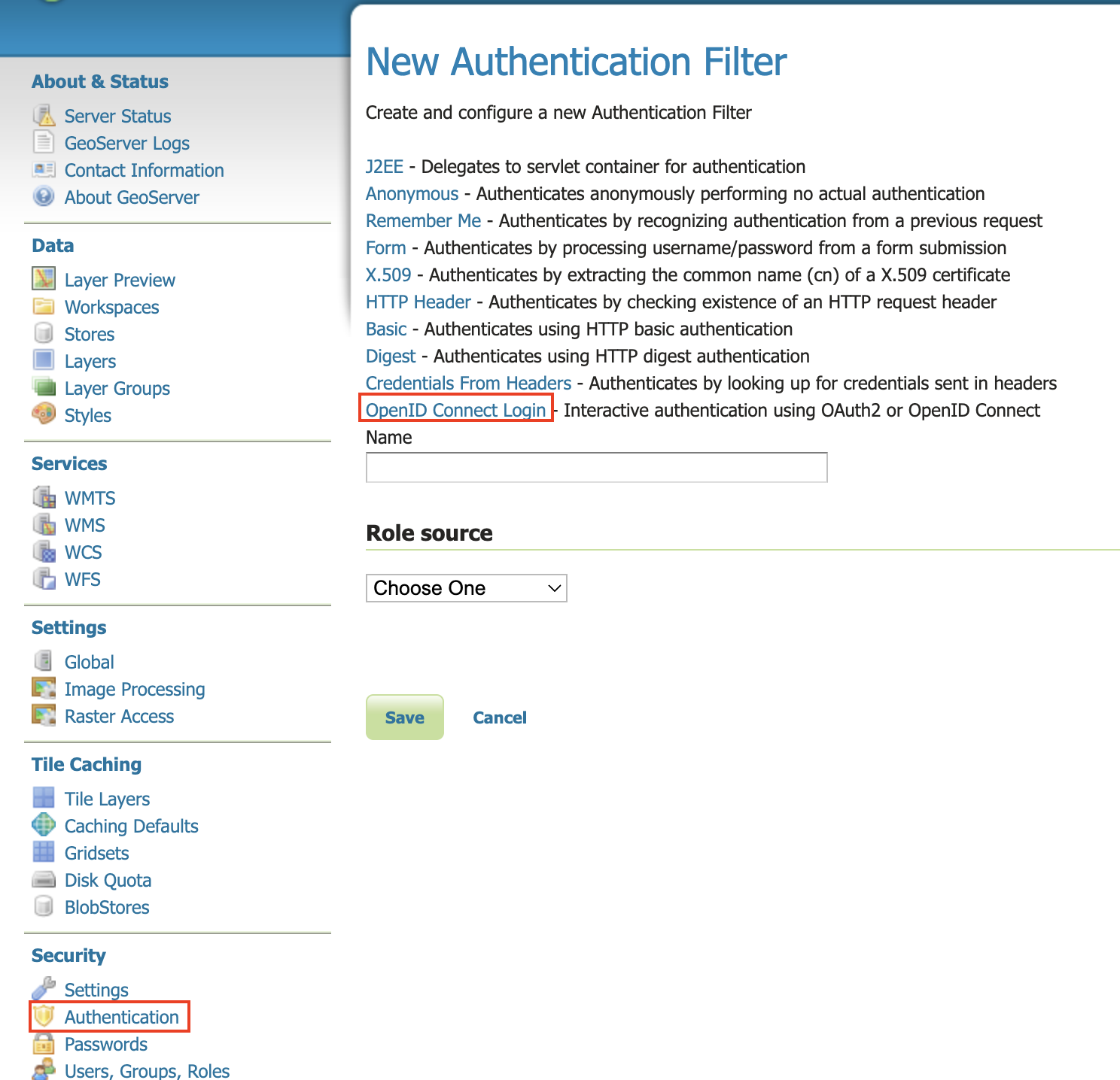
On the left bar under “Security”, click “Authentication”, and then “OpenID Connect Login”
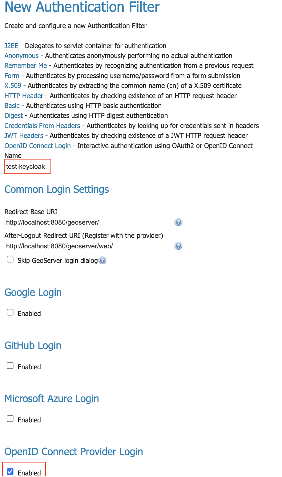
Give the it a name like “oidc-azure”, then click the “Microsoft Azure Login” checkbox.
Fill in the required information:
“Client Id” is the Azure “Application (client) ID”
“Client Secret” which was copied Zzure when you created it.
Press Save
Configure Role Role Source (ID Token)
When we configured Azure, we had it attach the roles to the ID token. We can use that to assign roles inside GeoServer.
Edit your “oidc-azure” security filter.
At the bottom, under “Authorization/Role source”, choose “ID Token”.
Use “roles” as the JSON Path
Use “geoserverAdmin=ROLE_ADMINISTRATOR” as the Role Converter
Tick the “Only allow External Roles that are explicitly named above”
Press Save
Configure Role Role Source (MS Graph) - Application Roles
Before you can use the MS Graph for permissions, you must give the app you created more permissions.
Setting up Azure
We need to setup azure so GeoServer can access the MSGraph and get the roles/groups the user is assigned to.
NOTE: in the ID token, the roles name is used (i.e. “geoserverAdmin”). However, in MSGraph, the role’s ID is used (a guid).
Login in to https://entra.microsoft.com/
Got to “App registration” (far left column), choose your application (“gs-azure-ap”), choose “API Permissions” (left column), then press “+ Add a permission”.
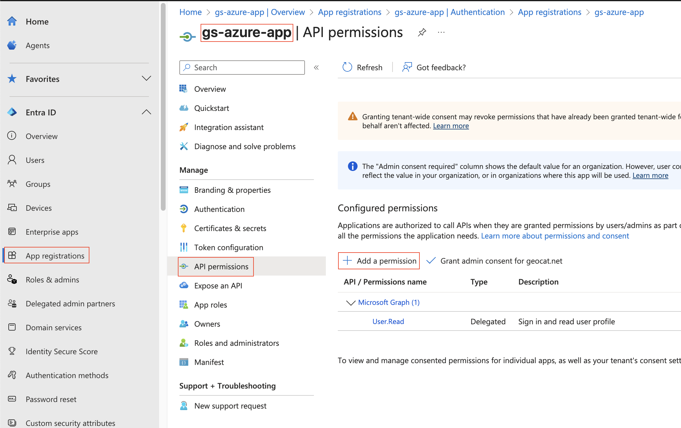
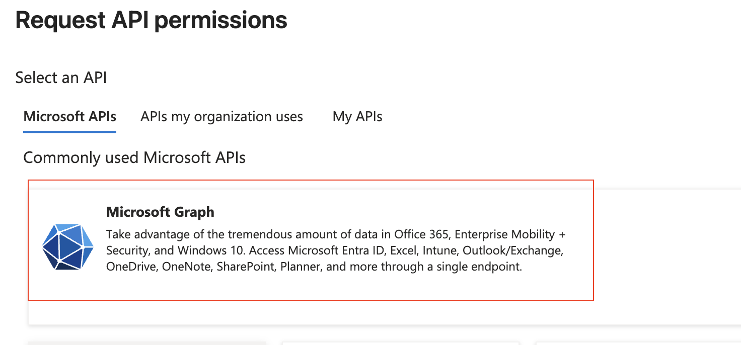
Choose “Microsoft Graph”
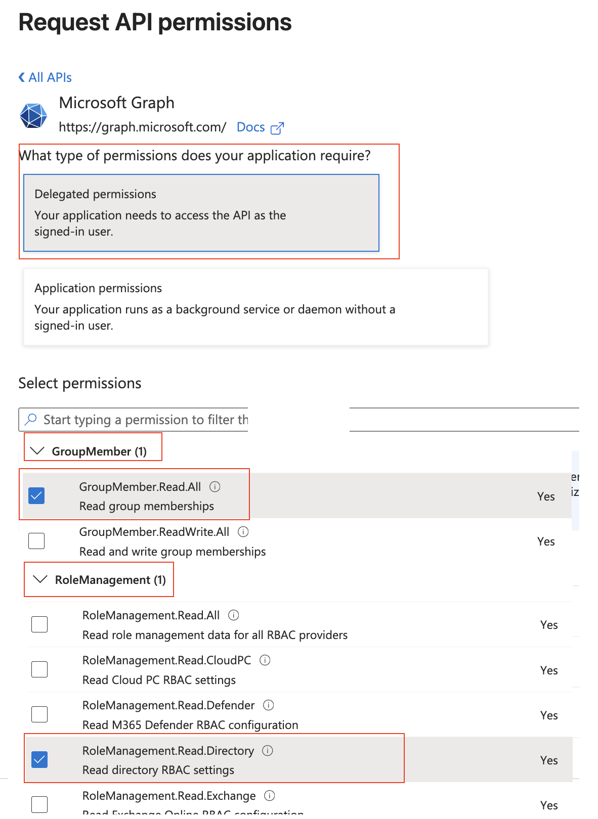
Then add the “GroupMember.Read.All” and “RoleManagement.Read.Directory” permissions and press “Add permissions”
At the top, select “Delegated permissions”
Scroll down to “GroupMember” and select “GroupMember.Read.All”
Scroll down to “RoleManagement” and select “RoleManagement.Read.Directory”
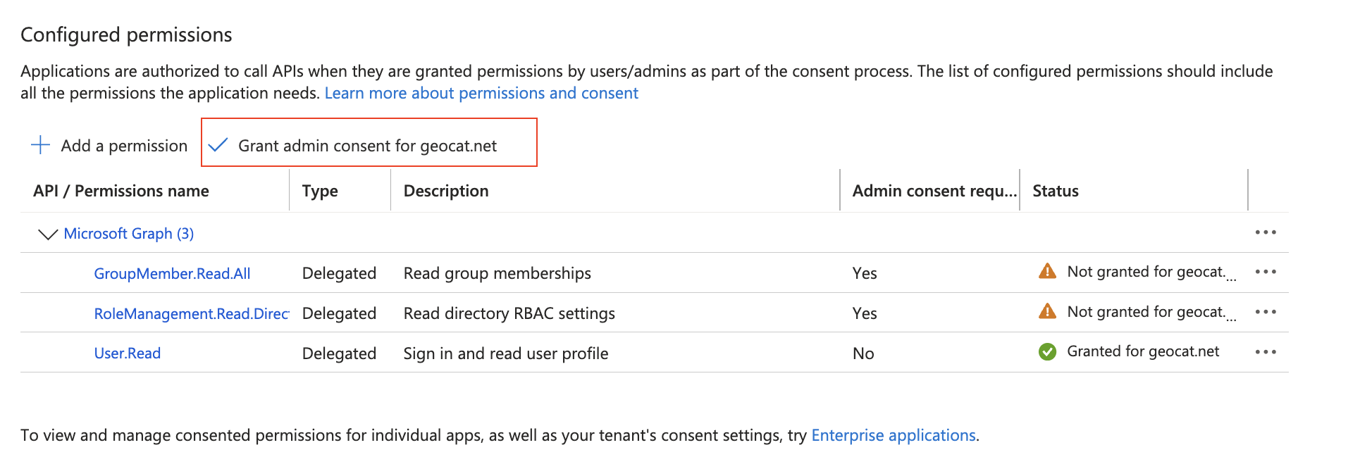
On the “Api permissions” screen, press “Grant admin consent for …”
This will pop-up a confirmation - press “Yes”
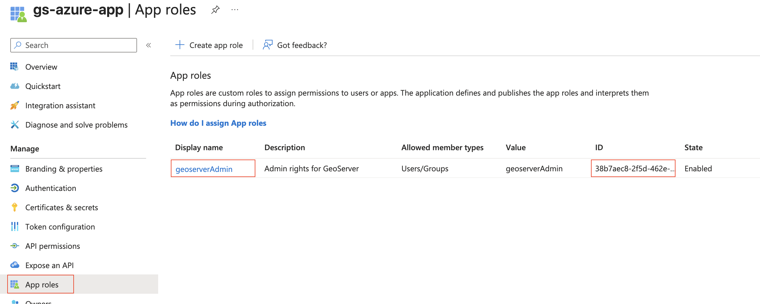
On the left column, press “App roles” and copy the ID for the “geoserverAdmin” role (its a guid). You will need this in the next step.
On the far left column, press “Enterprise Apps”, choose your application (“gs-azure-app”), and copy the “Object ID” (not the Application ID). You will need this in the next step.
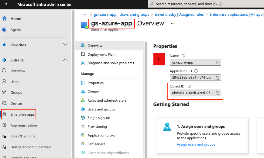
Setting up GeoServer
You will need:
“geoserverAdmin” role id (GUID)
Your enterprise application’s Object ID (GUID). This is NOT the Client ID.
Login into GeoServer as the ROLE_ADMINISTRATOR
On the left, go to “Security”->”Authentication”, and click on your OIDC filter (“oidc-azure”)
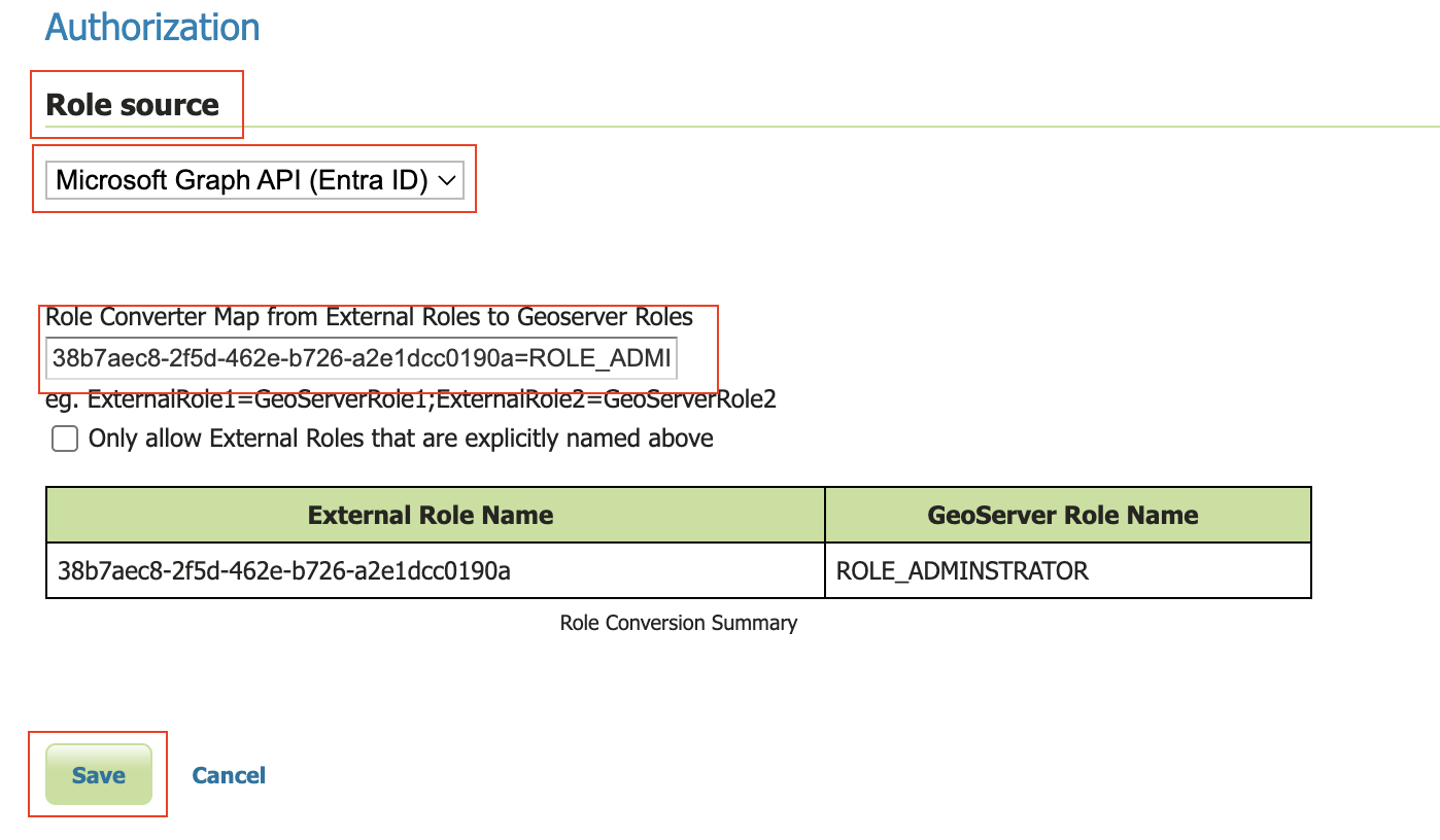
Scroll down to the “Authorization” section
Choose “Microsoft Graph (Entra ID)”
Turn on “Get Roles from the User’s Application Roles (MSGraph appRoleAssignments endpoint)”. GeoServer will retrieve the user’s roles from the MSGraph’s “appRoleAssignments”. These roles are the Role ID (GUID) not the name of the role.
In the “Object Id for the Azure Enterprise Application (NOT the Client Id)” box, put in your enterprise application’s Object ID (GUID).
In the converter map, use the role id (guid) for “geoserverAdmin” (found above) and put in “<your geoserverAdmin GUID>=ROLE_ADMINISTRATOR”
Press Save
Notes
See troubleshooting.
Typical MS ID Token. Note that the roles have been put in the “roles” claim.
{
    "aud": "594c52eb-e3a4-4c74-bbdf-ccc803383c99",
    "iss": "https://login.microsoftonline.com/87f91494-c0dc-493e-83c3-9226c111850a/v2.0",
    "iat": 1759773505,
    "nbf": 1759773505,
    "exp": 1759777405,
    "email": "david.blasby@geocat.net",
    "name": "david blasby",
    "nonce": "m3HsvD9JqU4uWbP1oPzP3Wb-n5u-aXdJAd",
    "oid": "6ac682b6-6048-4eb6-b4ca-2538e33cc",
    "preferred_username": "david.blasby@geocat.net",
    "rh": "1.AV8AlBT5h9zAPkmDw5ImwRGFCutSTFmk43RMu9_PAXZfAA.",
    "roles": [
        "geoserverAdmin"
    ],
    "sid": "009988c9-ae02-a521-d4cc-9aaf1a722",
    "sub": "oV3o_mu_PccTipAPJSpLJxzdzV2LKZv8mDQauGnY",
    "tid": "87f91494-c0dc-493e-83c3-9226c10a",
    "uti": "DfmjGZesdUODrGNYAA",
    "ver": "2.0"
}