Configuration of OGC API - Features module
The service operates as an additional protocol for sharing vector data along side Web Feature Service.
Service configuration
The service is configured using:
The existing Web Feature Service (WFS) settings to define title, abstract, and output formats.
This is why the service page is titled
GeoServer Web Feature Serviceby default.Contact information defined in Contact Information.
Extra links can be added on a per-service or per-collection basis as indicated in OGC API Service Configuration.
Feature Service conformances
The OGC API Feature Service is modular, allowing you to enable/disable the functionality you wish to include.
By default stable Standards and Community Standards are enabled. If WFS is strict, only official Standards are enabled and community standards are disabled
The OpenAPI service description is mandatory and may not be disabled.
The HTML and GeoJSON output formats are built-in and may not be disabled.
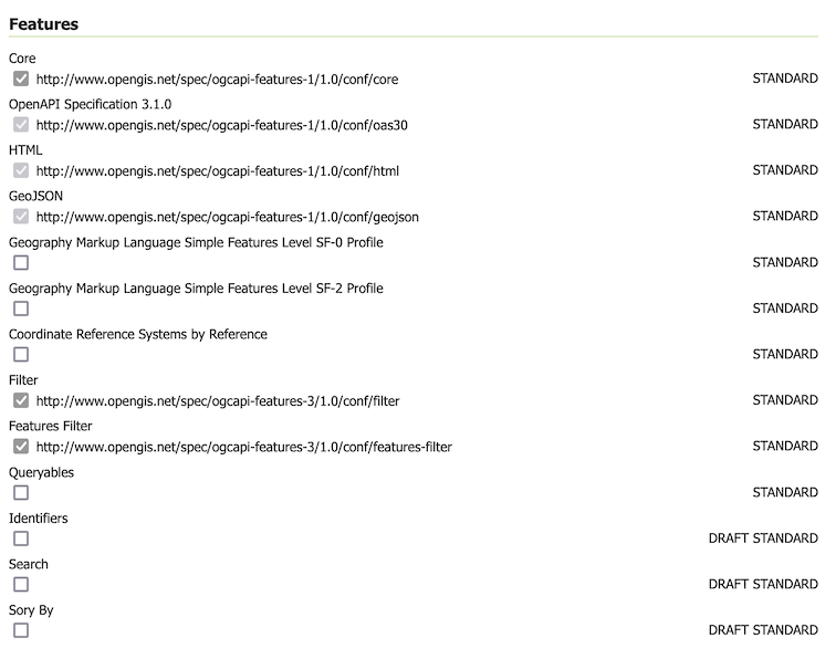
Feature Service Configuration
CQL2 Filter conformances.
Both the Text and JSON formats for CQL2 are available and may be enabled or disabled.
The remaining conformances reflect the built-in CQL2 implementation and may not be edited. The conformances marked enabled have been implemented, and the disabled conformances have not yet been implemented.
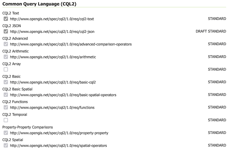
CQL2 Filter configuration
Control of ECQL Filter conformances
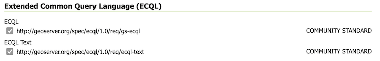
ECQL Filter configuration
For more information see OGC API - Features Implementation status.