Release Testing Checklist
A checklist of things to manually test for every release.
Artifact size
The binary release of GeoServer should be somehere around 45 - 46 megabytes.
Demos
Note
These are no longer available in GeoServer 2.0, we’ll probably reinstate them later
To do the demo page, http://localhost:8080/geoserver/demo.do, and test all of the demos. This includes:
WFS-T demo
GeoRSS demo with Google Maps, Virtual Earth, and Yahoo Maps
WMS Overlay demo
WMS Example
Sample requests
Go to the sample request page, http://localhost:8080/geoserver/web/?wicket:bookmarkablePage=:org.geoserver.web.demo.DemoRequestsPage, and execute every sample request, ensuring the correct response for each request.
Map preview
Go to the map preview page, http://atlas.openplans.org:8081/geoserver/web/?wicket:bookmarkablePage=:org.geoserver.web.demo.MapPreviewPage
Click the
OpenLayerslink next tonurc:ArcSample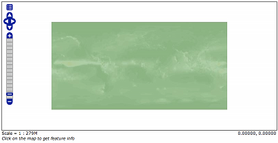
Go back to the map preview and click the
GeoRSSitem in the drop down choice next totopp:states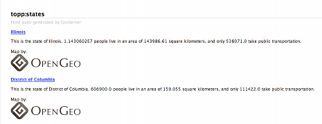
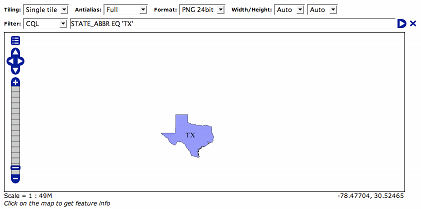
Go back to the map preview and click the
OpenLayerslink next totopp:states.Enable the options toolbar and specify the CQL filter:
STATE_ABBR EQ 'TX'
KML
Go back to the map preview and click the
KMLlink next totopp:statesOpen the result in Google Earth
Zoom out as far as possible and notice the smaller states (on the east coast) disappear.
Close Google Earth
Warning
If you do not shut down Google Earth it will cache information and throw off the next steps.
Go to the feature type editor page for the
topp:statesfeature typeChange the
KML Regionating Attributeto “SAMP_POP” and change theKML Regionating Strategyto “external-sorting”:.. image:: states_kml_config.png
Submit and Apply changes
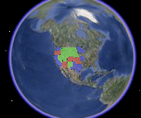
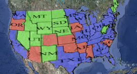
Go back to the map preview page and again click the
KMLlink next totopp:states, opening the result in Google EarthZoom out as far as possible and notice the smaller population states (green) disappear
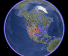
Go back to the map preview page and click the
KMLlink next tonurc:Img_Sample, opening the result in Google Earth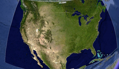
Zoom in and notice tiles load
Follow the link http://localhost:8080/geoserver/wms/kml?layers=topp:states&mode=refresh , opening the result in Google Earth
Notice the KML reload every time the camera is stopped
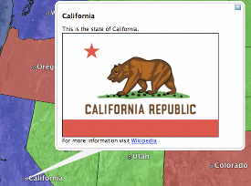
Edit the description template for the states layer as follows:
This is the state of ${STATE_NAME.value}.

<img src="http://www.netstate.com/states/symb/flags/images/${STATE_ABBR.value?lower_case}_fi.gif"/>
<br>
For more information visit <a href="http://en.wikipedia.org/wiki/${STATE_NAME.value}">Wikipedia</a>
Refresh the KML by moving the camera and click on a placemark
Append the parameter “kmscore=0” to the above link and open the result in Google Earth
Notice the rasterized version of the KML
Follow the link http://localhost:8080/geoserver/wms/kml?layers=topp:states&mode=download , saving the result to disk.
Examine the file on disk and notice a raw dump of all placemarks for the layer.
GeoWebCache
Go the geowebcache demo page, http://localhost:8080/geoserver/gwc/demo
Click the
EPSG:4326" link for ``topp:statesZoom in and notice the tiles load.
Repeat steps 2 to 3 for
EPSG:900913