The different types of web services in GeoServer include:
Open Web Services (OWS): WFS, WMS, WCS, WMTS, WPS and CSW.
OGC API Services: “OGC API – Features”
Other geospatial web services such as TMS, WMS-C
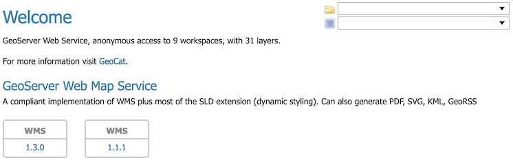
By default these services are global in that each web service publishes all GeoServer layers: WFS publishes all vector layer (feature types), WCS publishes all raster layers (coverages), and WMS publishes everything.
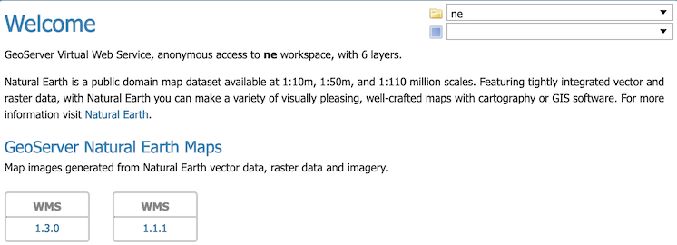
If you would like to have smaller web services, that only publish a few layers, you do not have to install multiple copies of GeoServer – make use of the idea of virtual services that only publishes a subset of the GeoServer layers.
When a client accesses a virtual service that client only has access to those layers published by that virtual service. Access to layers in the global service via the virtual service will result in an exception. This makes virtual services ideal for compartmentalizing access to layers. A service provider may wish to create multiple services for different clients handing one web service URL to one client, and a different web service URL to another client. Virtual services allow the service provider to achieve this with a single GeoServer instance.
Note
Virtual services only apply to the geospatial web services. It also does not apply to other subsystems such
as REST API used for configuration.
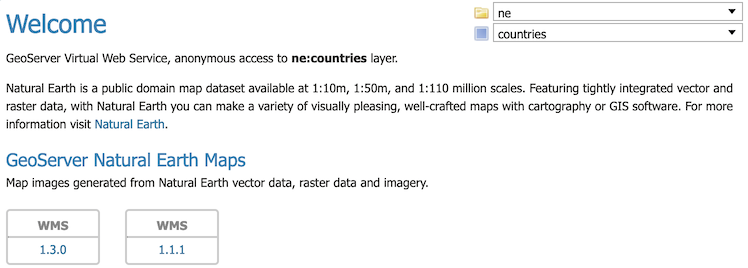
Workspace services are based on GeoServer workspaces. For each workspace that exists a virtual GeoServer exists along with it with its own Welcome Page and virtual web services. The virtual services publish only those layers that fall under the corresponding workspace.
Workspaces services restricted to a single workspace
Consider the following snippets of the WFS capabilities document from the GeoServer release configuration that list all the feature types:
The above document lists every feature type configured on the server. Now consider the following workspace service capabilities request which includes the name of a workspace in the virtual service URL:
The part of interest in the above request is the “ne” prefix to the wfs service. The above url results in the following feature types in the capabilities document:
The above feature types correspond to those configured on the server as part of the ne workspace.
The consequence of a virtual service is not only limited to the capabilities document of the service. When a client accesses a virtual service it is restricted to only those layers for all operations. For instance, consider the following WFS feature request:
The above request results in an exception. Since the request feature type tiger:roads is not in the ne workspace the client will receive an error stating that the requested feature type does not exist.
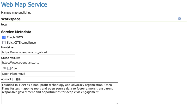
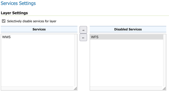
Each workspace service can be configured with their own title, abstract and service settings. This can also be used to enable/disable specific services on a workspace by workspace basis to control what virtual services are available.
Layer services are based on a single GeoServer layer or layer group. They use the workspace description of each web service but only contain a single layer or layer group.
A layer service further filters a global service by specifying the name of layer as part of the virtual service URL. For instance consider the following capabilities document:
The part of interest is the topp/states prefix to the wfs service. The above url results in the following WFS GetCapabilities document that contains a single feature type:
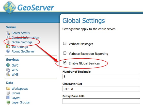
It is possible to completely restrict access to the global OWS services by adjusing Enable Global Services. When global access is disabled OWS services may only occur through a virtual workspace or layer service.
Any client that tries to access a service globally (i.e. not via a ‘/workspace’ or ‘/workspace/layer’ url) will receive an exception.
To disable global services, log into the GeoServer web administration interface and navigate to “Global Settings”. Uncheck the “Enable Global Services” check box.
When publishing XML content each FeatureType is published into an XML Namespace. This allows a layer with the same name to be differentiated as they end up with a unique qualified name (in the form <namespace>:<layer-name>). For this approach to avoid any conflicts each workspace is required to have a unique XML Namesapce.
Isolated workspaces allow GeoServer to configure two workspaces with the same XML Namespace, with the with the guarantee that can only be accessed different WFS or WMS Services. This places some restrictions (outlined in examples below) to ensure there is no opportunity for namespace conflict.
Isolated workspaces content is only visible and queryable in the context of a virtual service bound to the isolated workspace. This means that isolated workspaces content will not show up in global capabilities documents and global services cannot query isolated workspaces contents. Note that these restrictions do not apply to the REST API.
A workspace can be made isolated by checking the Isolated Workspace checkbox when creating or editing a workspace.
An isolated workspace will be able to reuse an XML namespace already used by another workspace, but its resources (layers, styles, etc …) can only be retrieved when using that workspace virtual services and will only show up in those virtual services capabilities documents.
It is only possible to create two or more workspaces with the same XML namespace in GeoServer if only one of them is non isolated, i.e. isolated workspaces have no restrictions in namespaces usage but two non isolated workspaces can’t use the same namespace.
At most only one non isolated workspace can use a certain XML namespace.
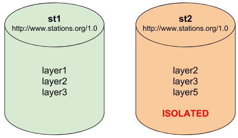
Consider the following image which shows to workspaces (st1 and st2) that use the same namespace (http://www.stations.org/1.0) and several layers contained by them:
Two workspaces using the same namespace, one of them is isolated.
In the example above st2 is the isolated workspace. Consider the following WFS GetFeature requests:
The first request is targeting WFS global service and requesting layer2, this request will use layer2 contained by workspace st1. The second request is targeting st2 workspace WFS virtual service, layer2 belonging to workspace st2 will be used. Request three and four will use layer2 belonging to workspace, respectively, st1 and st2. The last two requests will fail saying that the feature type was not found, isolated workspaces content is not visible globally.
The rule of thumb is that resources (layers, styles, etc …) belonging to an isolated workspace can only be retrieved when using that workspaces virtual services and will only show up in those virtual services capabilities documents.