Db2
Note
GeoServer does not come built-in with support for Db2; it must be installed through an extension. Proceed to Installing the Db2 extension for installation details.
The Db2 spatial support implements the OGC specification “Simple Features for SQL using types and functions” and the ISO “SQL/MM Part 3 Spatial” standard. When installing Db2 on Linux, Unix and Windows platforms, the “custom” option must be selected and the server spatial support included.
A free of charge copy of Db2 can be downloaded from https://www.ibm.com/analytics/db2/trials.
Installing the Db2 extension
Warning
Due to licensing requirements, not all files are included with the extension. To install Db2 support, it is necessary to download additional files. Just installing the Db2 extension will have no effect.
GeoServer files
Login, and navigate to and check Build Information to determine the exact version of GeoServer you are running.
Visit the website download page, change the Development tab, and locate the nightly release that corresponds to the GeoServer you are running.
Follow the Community Modules link and download
db2zip archive.3.0-SNAPSHOT example: geoserver-3.0-SNAPSHOT-db2-plugin.zip
The website lists active nightly builds to provide feedback to developers, you may also browse for earlier branches.
Extract the contents of the archive into the
WEB-INF/libdirectory in GeoServer.Warning
Verify that the version number in the filename corresponds to the version of GeoServer you are running (for example geoserver-3.0-SNAPSHOT-loader-plugin.zip above).
Restart GeoServer.
Required external files
The Db2 JDBC driver is not packaged with the GeoServer extension: db2jcc4.jar. This file should be available in the java subdirectory of your Db2 installation directory. Copy this file to the WEB-INF/lib directory of the GeoServer installation.
After all GeoServer files and external files have been downloaded and copied, restart GeoServer.
Adding a Db2 data store
When properly installed, Db2 will be an option in the Vector Data Sources list when creating a new data store.
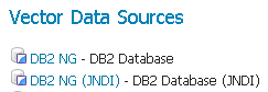
Db2 in the list of raster data stores
Configuring a Db2 data store
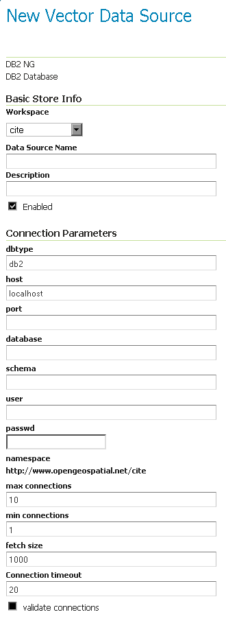
Configuring a Db2 data store
Configuring a Db2 data store with JNDI
Notes on usage
Db2 schema, table, and column names are all case-sensitive when working with GeoTools/GeoServer. When working with Db2 scripts and the Db2 command window, the default is to treat these names as upper-case unless enclosed in double-quote characters but this is not the case in GeoServer.