Publishing a Layer Group
This tutorial walks through the steps of publishing a layer group combining several layers into a basemap.
Note
This tutorial assumes that GeoServer is running at http://localhost:8080/geoserver.
Data preparation
First let's gather the data that we'll be publishing.
- Complete the previous tutorials:
- Publishing a GeoPackage defining the
tutorial:countrieslayer - Publishing a GeoTIFF defining the
tutorial:shadedlayer
- Publishing a GeoPackage defining the
Create a layer group
-
Navigate to Data > Layer Group page.
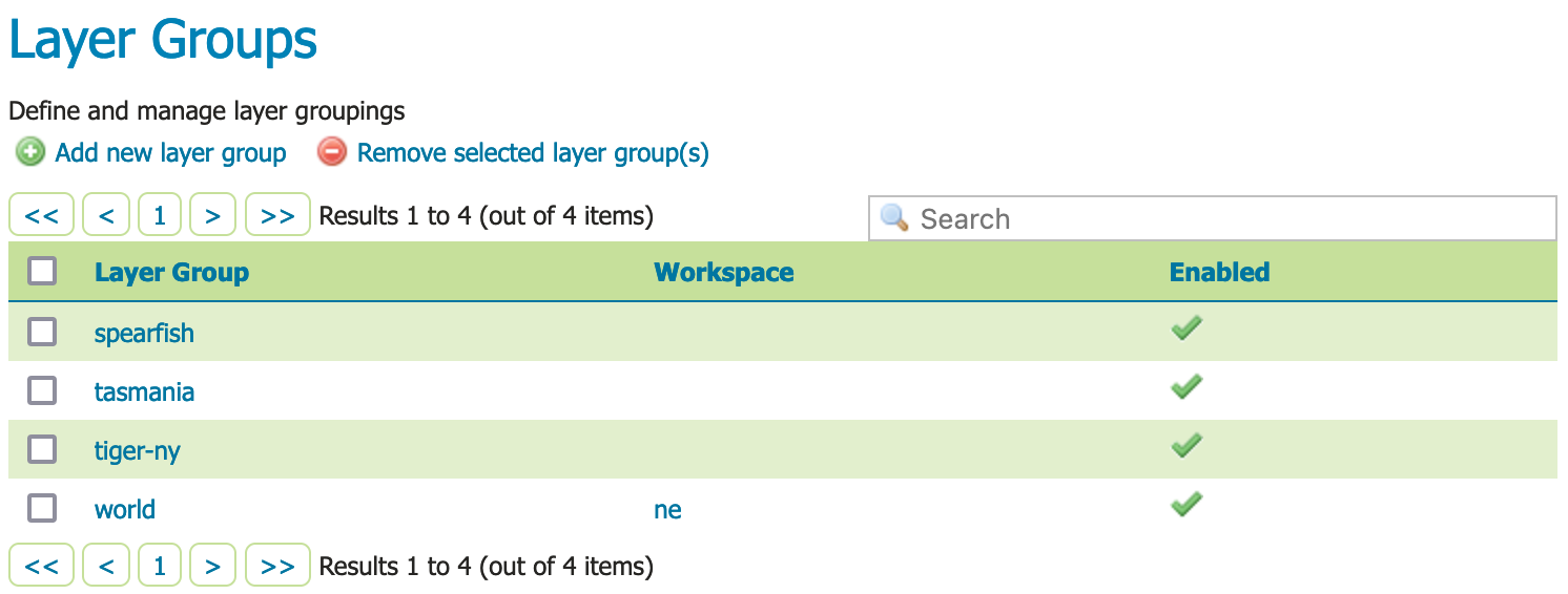
Layer Groups
-
This page displays a list of layer groups and the workspace the group belongs to.
Note
Layer groups are allowed to be "global", allowing a map to be created combining layers from several workspaces into a single visual.
-
At the top of the list Layer Groups locate and click the Add new layer group link.
-
The Layer group editor defines
- Basic Resource Info - describes how the layer is presented to others
- Coordinate Reference System - establishes how the spatial data is to be interpreted or drawn on the world
- Bounding Boxes - establishes where the dataset is located in the world
- Layers - the layers to be drawn (listed in draw order)
-
Locate Basic Resource Info and define the layer:
Name basemapTitle BasemapAbstract Plain basemap suitable as a backdrop for geospatial data.Workspace tutorial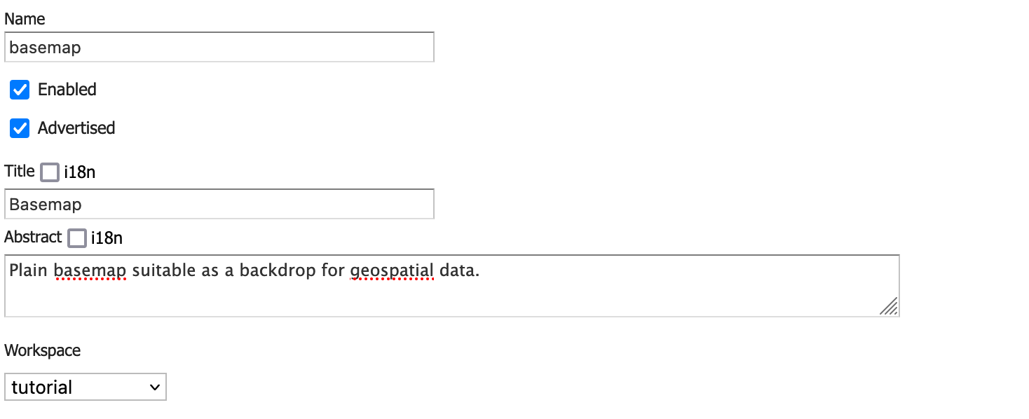
Basic resource information
-
Scroll down to the Layers list which is presently empty.
-
Click Add Layer link, select the
tutorial:shadedlayer first.The raster should be drawn first, as other content will be shown over top of it.
-
Click Add Layer link, select the
tutorial:countrieslayer second.This polygon layer will be drawn second.
-
Locate the
tutorial:countrieslayer in the list and click the Style entry to changepolygontoline.By drawing only the outline of the countries the shaded relief can show through.
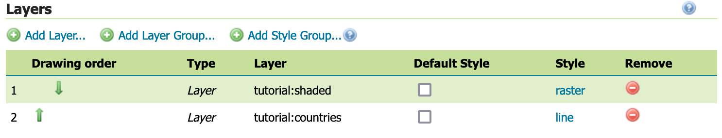
Layer group layers in drawing order
-
Locate the Coordinate Reference Systems and press Generate Bounds.
Now that layers are listed they can be used to determine the coordinate reference system and bounds of the layer group.
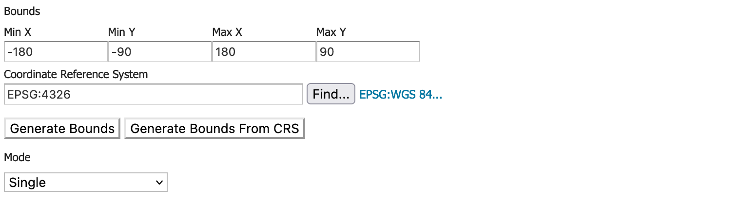
Coordinate Reference Systems
-
Press Save complete your layer group.
Previewing the layer
In order to verify that the tutorial:basemap layer is published correctly, we can preview the layer.
-
Navigate to the GeoServer > Browse Layers page and find the
tutorial:basemaplayer.Note
Use the Search field with
tutorialas shown to limit the number of layers to page through. -
Click the OpenLayers link in the Common Formats column.
-
An OpenLayers map will load in a new tab. This preview is used to zoom and pan around the dataset, as well as display the attributes of features.
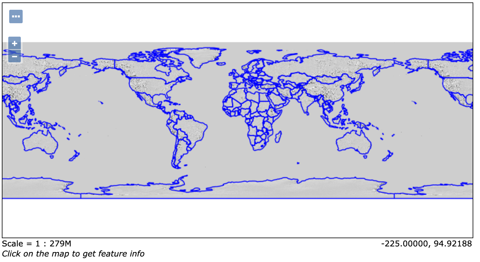
Preview basemap