Vector Mosaic Datastore Delegate Requirements
The Vector Mosaic Datastore Delegate is a datastore that contains references to the vector granule datastores, bounding polygon or multipolygon geometry to delineate the index area, and optionally other attributes that can be queried in order to return vector granules.
The delegate datastore can be in any format that GeoServer supports but there are two required fields:
There must be a geometry field representing the index spatial area in either Polygon or MultiPolygon form. There are not requirements on the name of such field.
There should be a field called
params, in text format, that contains either: * The name of a store already configured in GeoServer (useful to handle few granule stores, and avoid re-creating the store at every read). The string is considered a potential name if it does not contain an equal sign (making it a candidate for property format) or a colon or having path separators (making it a candidate for URI/URL). * The URI/URL pointing at granule resources like shapefiles, GeoPackage, FlatGeobuf, etc. (for simplicity). * A configuration string in .properties format. (See Java Properties file for more details about the format).
In addition to that, the following fields are optional:
* type indicates the typename to be used when querying the granule store. Useful when the target store can contain multiple feature types. If not present, it’s recommended to target a store with a single feature type (e.g., Shapefile, FlatGeoBuf).
* filter is a (E)CQL filter that can be used to cherry pick the features to be read from the delegate store. This is useful when the delegate store contains a large number of features, and only a subset of them are of interest for the given set of index record attributes.
Any other field beyond the two required can serve as queryable/filterable attribute, and will be used to narrow the number of potential granule vectors that are searched by a query. The non-required parameters will be combined with the vector granule parameters to create the output feature type.
An example of a delegate in property datastore format can be found here. The name field can be used to filter the granules, while params` contains the location of the granule file and ``geom its footprint. The type field can be used for filtering, but also indicates the name of the feature type to be used when querying the granule store (in this case, happens to match the name of the target shapefile).
Creating an Index with ogrtindex
The ogrtindex commandline tool from the GDAL library can be used to collect all data sets in a directory, and create an index table for it. The format of the location is slightly different than the one GeoServer expects, as it uses a location,tableIndex format, so a quick SQL needs to be run to make it match.
Here is an example that generates a delegate shapefile from a directory of shapefiles. The third step below uses ogr2ogr commandline to trim a comma and number that ogrtindex appends to the end of the granule reference, and to turn the file location into a valid URL.
Switch to directory with the shapefiles
ogrtindex -write_absolute_path -tileindex “params” delegate_raw.shp *.shp
ogr2ogr delegate.shp delegate_raw.shp -dialect SQLite -sql “SELECT Geometry,’file://’||SUBSTR(params,1,LENGTH(params)-2) AS params from delegate_raw”
The delegate.shp shapefile can then be published as a store in GeoServer (no need to publish the layer), and then the mosaic store can be created, referencing to it:
For example, let’s say one downloads the TIGER shapefile for the PLACE theme,
providing a shapefile with urban areas for each of the US states:
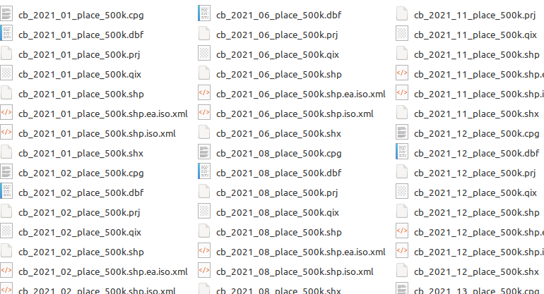
Scripts exist that help with the bulk download of the files for a given theme and year, e.g. get-tiger.
ogrtindex and ogr2ogr can be used to generate a index shapefile, which will be
then configured in GeoServer, and then serve as the base for mosaic store:
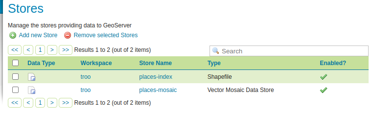
The store containing the delegate/index table, and the mosaic store
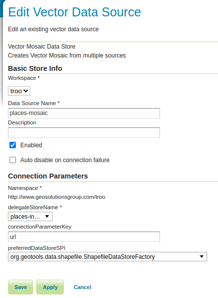
The mosaic store refers to the delegate store by name
The connectionParameterKey is url, as that’s what the Shapefile datastore is looking for,
a parameter named url with the location of the shapefile to open. The preferred SPI is
setup to the Shapefile store to speed up the lookup of the granule store (it can be omitted,
with a small performance drop).
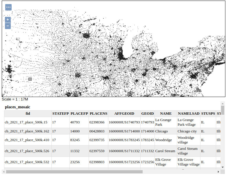
The mosaic layer can then be published in GeoServer, rendering all the required shapefiles in a single map:
Creating FlatGeobuf Granules with ogr2ogr and ogrtindex
FlatGeobuf files make for an excellent option for cloud storage of granule data due the built in support for R-Tree indices and the use of HTTP Range requests to limit the amount of data streamed over the network.
ogr2ogr can be used to convert a directory of shapefiles into a directory of indexed Flatgeobufs using a simple bash script like below
#!/bin/bash
shopt -s nullglob
FILES="/data/tiger/*.shp"
for f in $FILES
do
  fgbfilename="$(basename $f .shp).fgb"
  ogr2ogr -f FlatGeobuf $fgbfilename $f -nlt PROMOTE_TO_MULTI -lco SPATIAL_INDEX=YES
done
Here is an example that generates a delegate shapefile from the directory of FlatGeobufs. The third step below uses ogr2ogr commandline to trim a comma and number that ogrtindex appends to the end of the granule reference, and to turn the file location into a valid URL. Note the exclusion of the write_absolute_path. Instead we append the AWS S3 bucket URL to the generated filename.
Switch to directory with the FlatGeoBufs.
ogrtindex -tileindex “params” delegate_raw.shp *.fgb
ogr2ogr delegate.shp delegate_raw.shp -dialect SQLite -sql “SELECT Geometry,’https://mybucketname.s3.amazonaws.com/’||SUBSTR(params,1,LENGTH(params)-2) AS params from delegate_raw”
Upload FlatGeobuf granule files to the S3 bucket referenced in the earlier step (and confirm that the bucket contents are publicly available).
At this point you can publish the delegate.shp shapefile as a store in GeoServer as described in the previous example or you can load it into PostGIS before publication (see Smart Data Loader for a tool for creating the PostGIS store). A PostGIS delegate is especially useful mosaics that might change over time due to support for concurrent edits, high rate loading and transactions. Note that because the granule references in the index are HTTPS URLs the index FlatgeoBuf can be hosted anywhere that your GeoServer installation can access.