GeoPackage
GeoPackage is an SQLite based standard format that is able to hold multiple vector and raster data layers in a single file.
GeoPackage files can be used both as Vector Data Stores as well as Raster Data Stores (so that both kinds of layers can published).
Adding a GeoPackage Raster (Mosaic) Data Store
By default, GeoPackage (mosaic) will be an option in the Raster Data Sources list when creating a new data store.

GeoPackage (mosaic) in the list of raster data stores
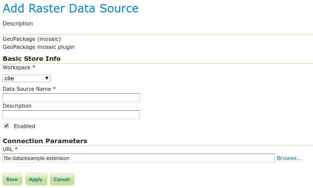
Configuring a GeoPackage (mosaic) data store
Option |
Description |
|
Name of the workspace to contain the GeoPackage Mosaic store. This will also be the prefix of the raster layers created from the store. |
|
Name of the GeoPackage Mosaic Store as it will be known to GeoServer. This can be different from the filename. ) |
|
A full free-form description of the GeoPackage Mosaic Store. |
|
If checked, it enables the store. If unchecked (disabled), no data in the GeoPackage Mosaic Store will be served from GeoServer. |
|
Location of the GeoPackage file. This can be an absolute path (such as |
When finished, click Save.